Causes of the Tapanuli Flood According to Satya Bumi: Industrial Activity Degrades the Ecosystem || Stay In News
Stay In News - Satya Bumi argues that ecological degradation caused by industrial activities has weakened nature’s ability to absorb water. Damage in the upstream areas of the river has triggered severe flooding downstream.
/2025/11/25/586445469.jpg)
According to Satya Bumi, the massive floods that struck the Tapanuli region of North Sumatra were not solely caused by extreme weather and tropical cyclones. Years of environmental deterioration without restoration have intensified the impacts of the climate crisis, particularly in South Tapanuli and Central Tapanuli, which are now experiencing the worst flooding.
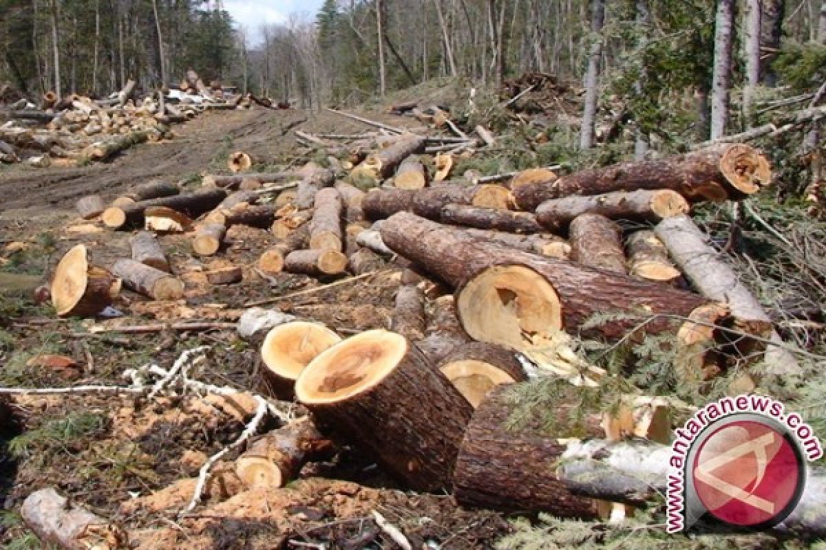
Satya Bumi Campaigner, Riezcy Cecilia Dewi, explained that deforestation, unsustainable land clearing, and ecosystem degradation have reduced the environment’s natural water-absorption capacity. During heavy rainfall, water flows rapidly, carrying logs from upstream to downstream and destroying homes, infrastructure, and farmland.
“Many widely circulated videos show extremely strong river currents carrying wood fragments believed to come from the upper reaches of the Batang Toru River in the Harangan Tapanuli area,” she said in a written statement on Friday, November 28, 2025.
Water flowing from upstream becomes even more destructive when forests are damaged. The soil becomes unstable, landslide-prone, and lacks trees that once served as natural soil binders.
Satya Bumi also highlighted industrial activities that continue to pressure the Batang Toru ecosystem—the only habitat of the Tapanuli Orangutan. Environmental destruction in this ecosystem, which plays a crucial hydrological role, is seen as a key driver of the largest disaster in decades.
The expansion of the Martabe gold mine has been ongoing since 1997. Although its concession area was reduced in 2018, deforestation continued. PT Agincourt Resources expanded the mining area from 509 hectares in January 2022 to 603.21 hectares by October 2025, most of which consisted of intact forest.
In 2020, the company planned to increase production capacity from 6 million to 7 million tons per year, including the construction of a 583-hectare tailings facility requiring extensive land clearing. “Building the TMF requires large-scale land clearing. About 195.2 hectares will be opened, with the potential loss of 185,884 trees,” Riezcy stated.
This clearing does not include saplings and smaller trees beneath the canopy. Satya Bumi believes this deforestation was known, approved, and facilitated by the government.
In addition to mining, the Batang Toru hydropower plant—expected to be completed by late 2025—is considered insufficient to control large water volumes from the upstream region. The presence of dams and water tunnels in such a sensitive landscape may increase vulnerability, especially as water patterns shift due to deforestation.
Landscape Pressured by Energy and Natural Resource Projects
Satya Bumi urges the government to review permits for extractive industries and land-use changes around the Batang Toru ecosystem. Regulators are also encouraged to temporarily halt palm-oil expansion and other industries that threaten river basins, while restoring upstream areas through community-based rehabilitation.
Several projects are considered to be placing pressure on the landscape, including the Pahae Julu Micro-Hydropower Plant, the Sorik Marapi geothermal project in Mandailing Natal, the industrial-forest replanting program by PT Toba Pulp Lestari around Lake Toba, and palm-oil plantations owned by PT Sago Nauli and PTPN III.
PT Agincourt Resources (PTAR) previously claimed that its mining operations are not linked to the flash floods in Central Tapanuli. The company stated that the disaster occurred in the Aek Ngadol watershed, while the Martabe mine operates in the Aek Pahu watershed, meaning the two areas are not connected.