Root Cause of Sumatra’s Devastating Flash Floods Revealed, ITB Experts Explain the Science Behind It || Stay In News
Stay In News - Sumatra is currently mourning a series of deadly natural disasters. Massive landslides and flash floods have struck several regions, including West Sumatra, North Sumatra, Aceh, and nearby areas.
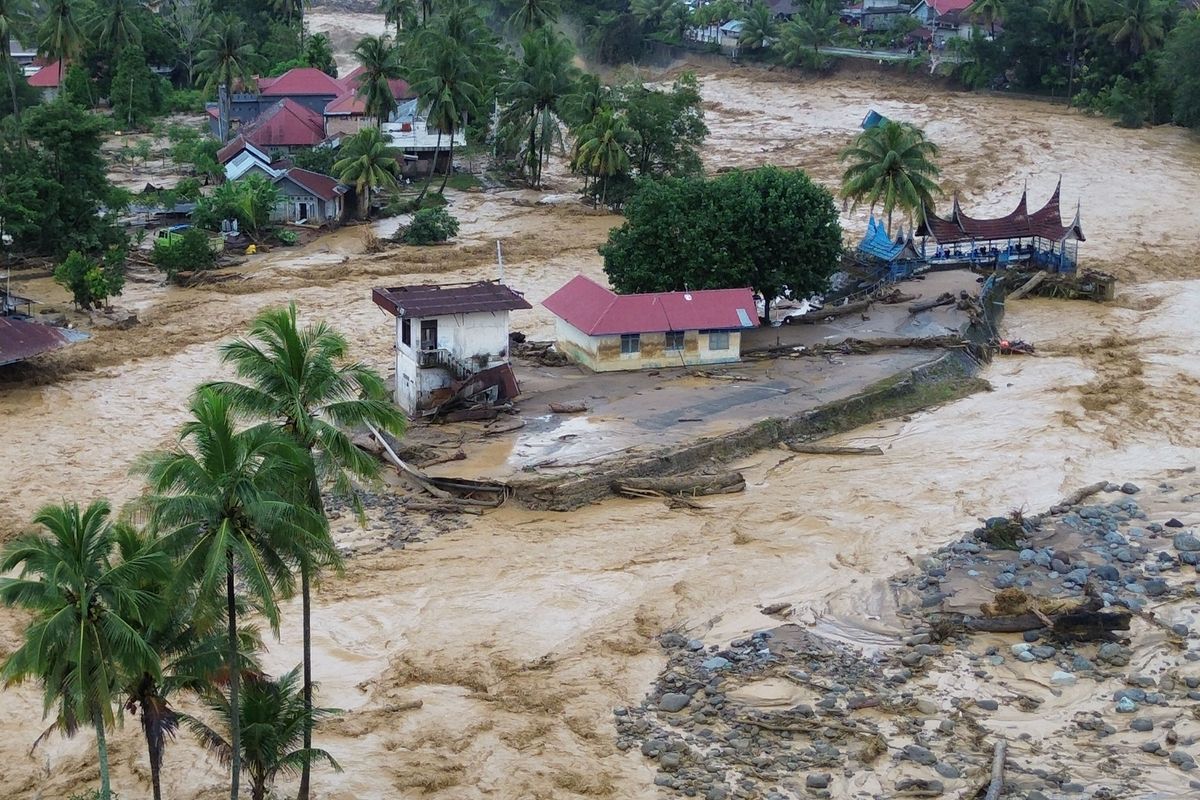
These disasters have caused numerous casualties, with more than 100 people reported dead as of November 28, 2025, according to the National Disaster Management Agency (BNPB).
The widespread destruction has drawn national attention. Many are now questioning what truly triggered the severe flash floods across Sumatra.
Central Sumatra Hit Peak Rainy Season
Dr. Muhammad Rais Abdillah, a meteorology expert and lecturer from the Atmospheric Science Research Group at Bandung Institute of Technology (ITB), explained that the first major factor behind the disaster was extremely high rainfall. Central Sumatra is currently experiencing the peak of its rainy season.
“Regions in Tapanuli are entering the rainy season. Northern Sumatra generally has a year-round rain pattern or two annual rainfall peaks, and this period marks one of them,” he said, quoted from ITB’s official website on Saturday (29/11/2025).
Data from the Meteorology, Climatology, and Geophysics Agency (BMKG) recorded rainfall intensity of 150–300 millimeters, placing recent rainfall in the extreme category.
Cyclonic Circulation Intensifies Rainfall
Rais observed the presence of a cyclonic vortex around northern Sumatra, which further intensified rainfall. This system later developed into Tropical Cyclone Senyar, forming near the Malacca Strait and moving westward.
“On November 24, we began to detect a rotating system originating from Peninsular Malaysia. In meteorology, we call it a vortex, although it was initially just a low-pressure seed without a clearly visible eye,” he explained.
Although the cyclone was not as strong as those in the Pacific or Indian Oceans, it still contributed significantly to raincloud formation.
Additional atmospheric factors at the meso and synoptic scale also played a role, such as strong northerly winds carrying moist air that fueled storm cloud development.
Environmental Degradation Worsened the Flood Impact
Beyond rainfall, the scale of destruction was amplified by the reduced environmental capacity to absorb water.
Dr. Heri Andreas from ITB’s Geodesy and Geomatics Engineering Program stated that land-use changes have weakened natural absorption.
“When precipitation occurs, some water infiltrates the ground while the rest becomes surface runoff. The proportion depends heavily on land cover and soil characteristics,” Heri explained.
He noted that the conversion of forests into plantations and settlements has significantly reduced water retention capacity. Heri emphasized the urgent need for risk-based spatial planning, conservation of natural water catchments, and geospatial modeling for long-term mitigation.
“When natural water buffers disappear, the area loses its ability to hold runoff. As a result, rainfall flows rapidly into rivers and triggers flash floods,” he added.
Rais also highlighted the importance of accurate, science-driven weather early warnings, along with strong disaster education to reduce future risks.